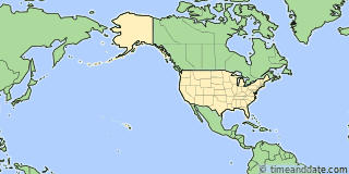
| Country: | United States |
|---|---|
| Lat/Long: | 19°44'N / 155°05'W |
| Currency: | United States Dollar (USD) |
| Languages: | English |
| Country Code: | N/A |


Holiday Note: Dec 25, Christmas Day. Businesses may be closed. See more
More Sun & Moon in 19°43'46.9"N, 155°05'24.0"W
+ Show More Twilight and Moon Phase Information
Solar Noon
Sun in South: 12:18 pm
Altitude: 46.8°
Altitude: 46.8°
Astronomical
Twilight
5:32 am – 5:59 am
6:38 pm – 7:05 pm
6:38 pm – 7:05 pm
Nautical
Twilight
5:59 am – 6:26 am
6:11 pm – 6:38 pm
6:11 pm – 6:38 pm
Civil
Twilight
6:26 am – 6:50 am
5:47 pm – 6:11 pm
5:47 pm – 6:11 pm
Previous
Moon Phase
Full Moon
December 14, 2024
11:01 pm
December 14, 2024
11:01 pm
Next
Moon Phase
Third Quarter
December 22, 2024
12:18 pm
December 22, 2024
12:18 pm

Airports
- Hilo International Airport, ITO
About 3 mi ESE of 19°43'46.9"N, 155°05'24.0"W - Kona International Airport, KOA
About 62 mi W of 19°43'46.9"N, 155°05'24.0"W

19°43'46.9"N, 155°05'24.0"W
USA
1:4912am
Saturday, December 21, 2024


